This webpage provides an overview on data products that are used in this project. For detailed information on each product please visit the appropriate link.
Observational data
 Observational information is used in our research activity for purposes of analysis to characterize historical records, identify/understand factors and mechanisms leading to these important events, and validate our model products. This includes data from a variety of sources
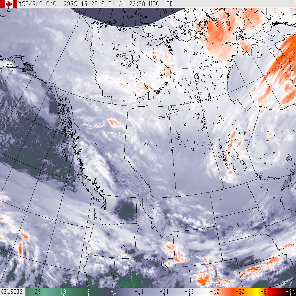
- Satellite and radar information
- Lightning information (as signatures of heavy precipitation rates)
- Station information.
Climate model output
This type of data consists of the outputs of multiple climate research models and types of simulations
- Global climate model simulations
This product is useful for studying mechanisms and development of large-scale climate systems as well as quantifying uncertainties. Information includes simulations from CMIP5 and CMIP6 when they become available and large ensemble simulations that have been performed at some research centres, such as the Canadian Centre for Climate Modelling and Analysis (CCCma) and the National Center for Atmospheric Research (NCAR).
- Conventional regional climate model simulations
This product includes dynamically downscaled simulations from global models at spatial resolutions ranging from 0.44° to 0.11°, using
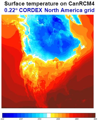
- CanRCM4
The Canadian Regional Climate Model 4 (CanRCM4) is a regional climate model developed at the Canadian Centre for Climate Modelling and Analysis (CCCMA) based on a close association between the regional and the global climate modelling.
- CRCM5
The fifth-generation Canadian Regional Climate Model (CRCM5) developed at the University of Québec at Montréal and by groups participating in the CORDEX North America RCM inter-comparison project. It is based on the limited-area version of the numerical weather-prediction Global Environmental Multiscale (GEM) model developed by Environment and Climate Change Canada. For more information and data access, please contact: winger.katja@uqam.ca.
- CanRCM4
- Convection permitting WRF model
The Weather Research and Forecasting (WRF) is a next-generation numerical weather prediction model with a very high spatial resolution (4km). This model was developed in collaboration with several atmospheric research centers, mainly, the National Center for Atmospheric Research (NCAR) and the National Oceanic and Atmospheric Administration (NOAA). Designed with a highly complex convection-allowing configuration, this tool offers an efficient and flexible platform for both operational applications and atmospheric researches.
Two 13 years simulations were performed by NCAR, consisting of a retrospective simulation (October 2000 to September 2013) with initial and boundary conditions from ERA-Interim and a future climate sensitivity simulation with initial and boundary conditions derived from reanalysis and modified by adding the CMIP5 ensemble mean of the high emission scenario climate change [link].
The information of the currently available data, the western Canada 4-KM WRF and CONUS I, is listed here:Methods to access data