Estimating Soil Moisture Using Drones
Efficient and accurate estimations of soil moisture are key for proper crop irrigation management.
By: Yusof Ghiasi, Claude Duguay, Armaghan Salehian, Justin Murfitt
September 17, 2020
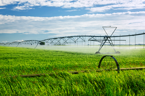
To address the need for an efficient way to measure soil moisture content for irrigation planning on smaller farms, University of Waterloo (UW) researchers conducted an experiment at the UW Environmental Reserve and evaluated the ability of GPS-Reflectometry for soil moisture content monitoring over small- and medium-sized vegetated areas using a drone. Soil water content is considered one of the most prominent drivers in agricultural management; it is of high importance for plant growth and crop yields and has an influential role in groundwater recharge. In particular, soil water content serves as a solvent and carrier of nutrients, regulates soil temperature, and empowers microorganisms to conduct their metabolic activities. With estimates showing that the agriculture sector dominates freshwater use, consuming 85-90 per cent of the total available freshwater for irrigation, irrigation practices can greatly interfere with water supplies and have significant consequences. It is vital to properly manage the irrigation of farmlands to mitigate these impacts on water.
Classic Methods of Soil Moisture Estimation
![]()
Manual Methods
Manual methods are arguably the most accurate way to obtain soil moisture values. Two common manual methods to measure soil moisture are gravimetric determination and the use of a soil moisture probe. Both of these manual methods are labour intensive and can take an extremely long time to properly analyze even a medium-sized farm.
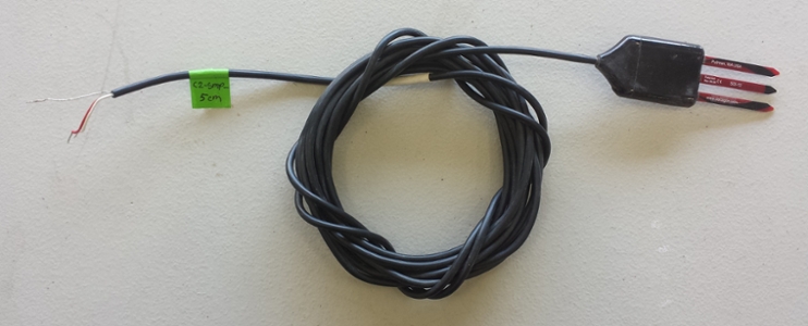 Example of a soil moisture probe.
Remote Sensing Techniques
Various remote sensing techniques (ground-based, aerial, and space platforms) can also be used to determine soil moisture content. Land remote sensing with signals of opportunity (existing microwave signals which are reflected from surfaces, such as soil) has shown a unique potential in cost-effective monitoring of soil moisture content and variation. The most familiar example is GPS (Global Positioning System) signals, which can be recorded and analyzed through reflectometry to study the effect of soil water content on the GPS signals. The capability of GPS-Reflectometry for soil moisture content estimation has been demonstrated by airborne measurements (satellites and planes) at large scales; however, it had not yet been tested using a drone or for small- and medium-sized farmlands.
Evaluating Use of GPS-Reflectometry Sensors on Drones
![]()
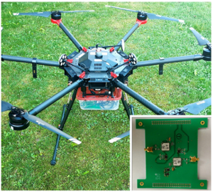
Two GPS antennas were mounted to a drone to receive both direct signals from GPS satellites and reflected signals from the soil surface. The GPS-Reflectometry sensor used in this experiment is a low-cost system initially designed for the University of Waterloo's team (WatSat) competing in the Canadian Satellite Design Challenge (CSDC). The strength of the reflected signal, or SNR (signal-to-noise ratio), was extracted and considered as a factor for surface reflectivity. Increased soil water content is expected to result in more reflectivity measured by the GPS-Reflectometry system.
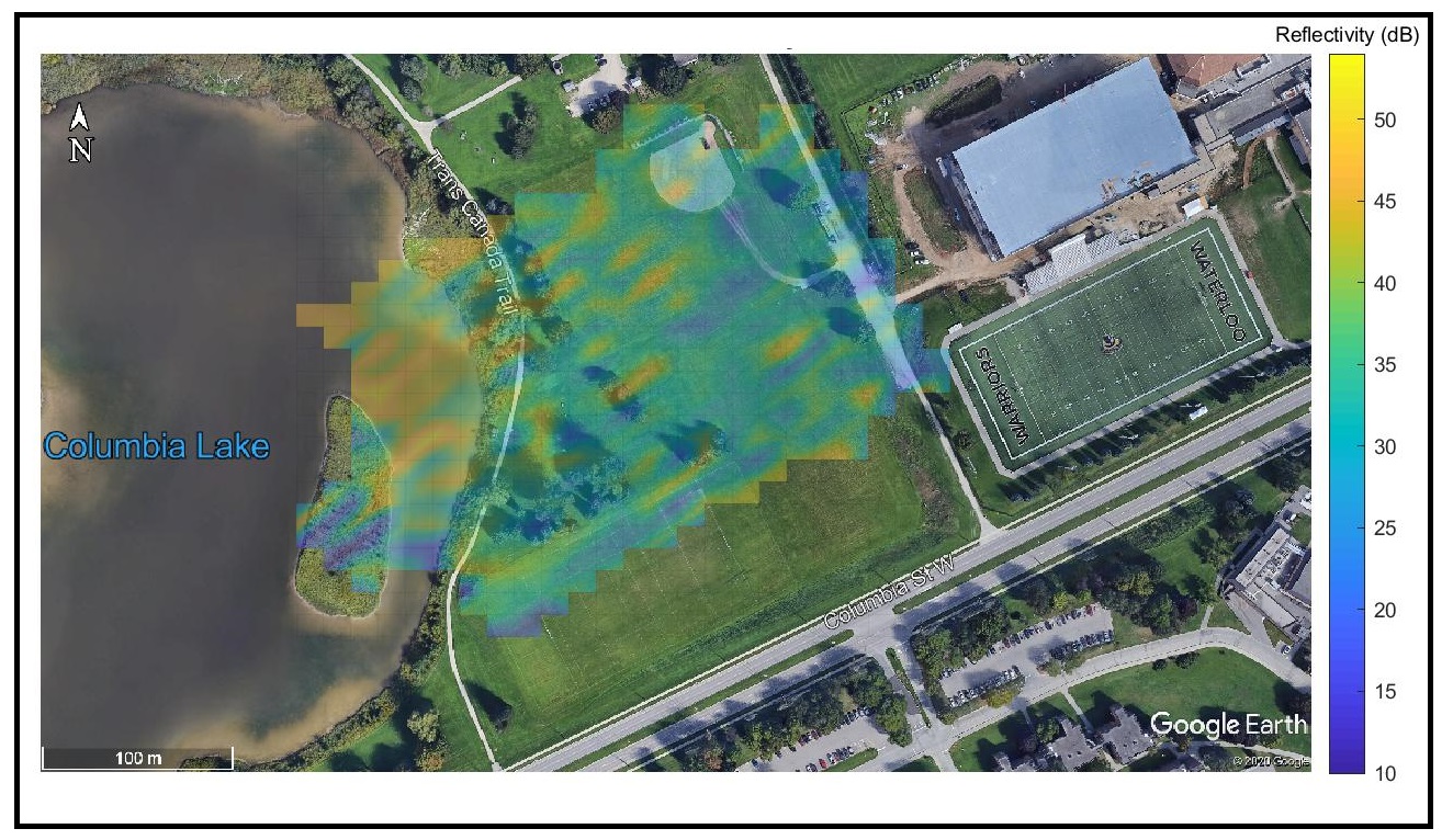
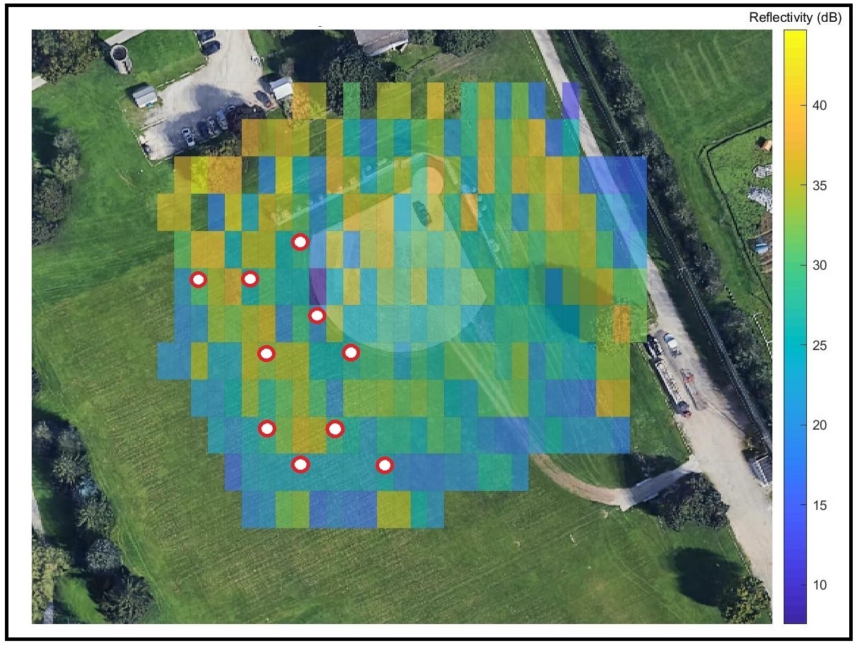
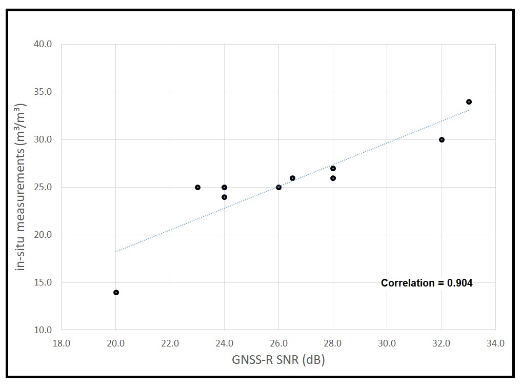
The experiment was comprised of two parts: (1) a flight over a larger area covering multiple textures including a vegetated area, trees, and a lake; and (2) a flight over a smaller area accompanied by some manual soil moisture measurements as ground-truth controls.
Results from the first flight show that the GPS-Reflectometry sensor mounted to the drone is able to discern surfaces with high water content, such as the lake, from other land covers due to the difference in the reflectivity and SNR values. The results of the second flight are also promising as a good agreement is achieved between manual measurements and GPS-Reflectometry retrievals. Measuring the soil moisture content at 10 points and comparing the results with the reflectivity values, we could estimate the soil moisture content with around 90 per cent accuracy.
This experiment has shown that using GPS-Reflectometry sensors mounted on drones flown at smaller scales can be a cost-efficient way to determine the soil moisture content of farmlands. Drones and sensors are becoming more affordable and farmers can use this as a tool to increase their irrigation efficiency and optimize their plant growth and yields. It could also help reduce the over-irrigation of fields as runoff can have negative impacts on the water quality downstream.
Contact
For inquiries, please contact Yusof Ghiasi.
Yusof Ghiasi's research contributes to the Global Water Futures Transformative Sensor Technologies for Smart Watersheds project led by Dr. Claude Duguay at the University of Waterloo.
GWF2020 Scientific Poster
Video: Water Content Retrieval Using GNSS Reflectometry