
Predicting River Ice Jams to Improve Flood Forecasting
Dr. Lindenschmidt is collaborating with Manitoba Infrastructure to forecast Ice-Jams along the Red River using his methodology for RIVICE Modelling
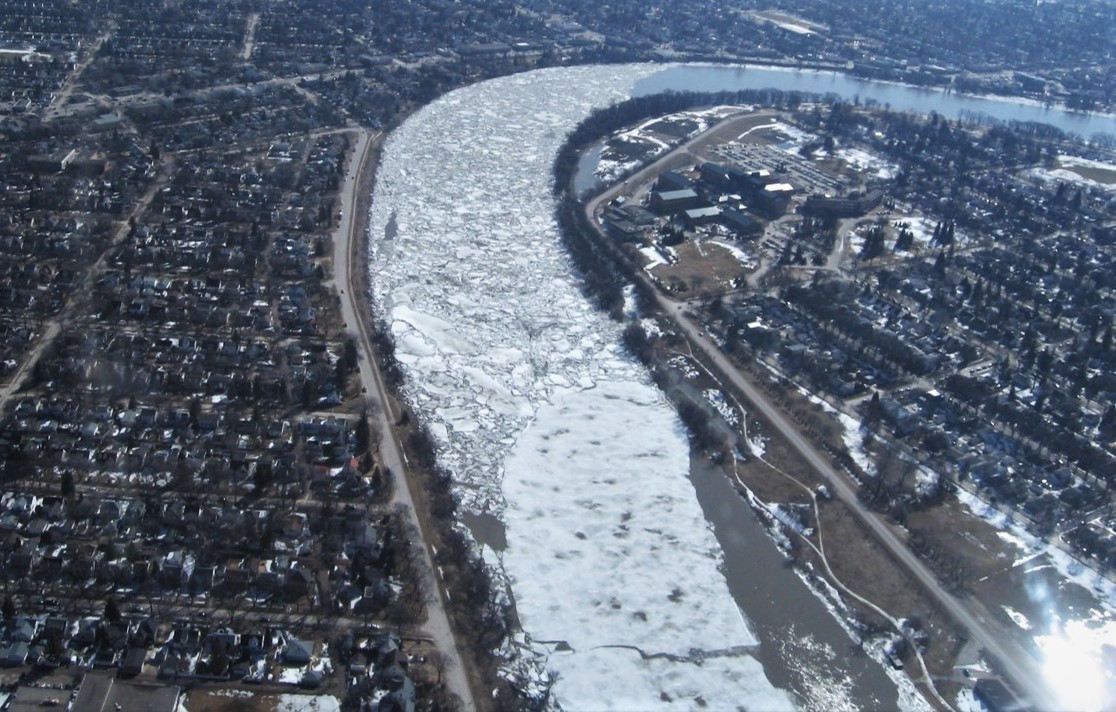
When we hear about a river flood, we might assume there has been a heavy downpour or warm spring temperatures causing rapid snowmelt. Ice-jams are, however, a significant contributor to flooding.
Much of Manitoba’s 2009 Red River flood, one of the five worst floods in Canadian history, was caused by ice-jamming, forcing water to back up and flow over the banks of the river. This flood event caused $38.5 million in direct financial losses and damaged 250 homes. Severe ice-jamming was also a significant factor in the Red River floods of 2004 and 2007.
Better prediction of river ice and jamming potential would improve estimates of ice-jam flood probabilities that can feed into planning, infrastructure development, and flood-control mitigation programs, ultimately reducing flooding risk. It would also help governments and water managers make more informed decisions on cost effectiveness and more strategically direct ice-cutting operations and artificial ice-cover breakup programs.
Karl-Erich Lindenschmidt, an associate professor at the University of Saskatchewan’s Global Institute for Water Security, is investigating river-ice processes as part of a modelling project involving four Canadian universities, 12 government agencies, and more than 10 end-user communities. The project is part of the USask-led Global Water Futures program, funded by the Canada First Research Excellence Fund.
“Predicting exactly when the ice will break up and cause flooding along a river is a sophisticated task due to the chaotic nature of ice-jam formation caused by varying conditions and the distinct types of ice cover formed,” said Lindenschmidt.
He has successfully introduced a modelling method using the RIVICE platform to mimic chaotic ice-jam formation and predict the probability of jamming and potential flooding.
The method has been applied to several river systems across Canada, including in a fully automated, real-time flood forecasting system of the Government of Newfoundland and Labrador for the Churchill River in Labrador. Manitoba is taking steps to use the modelling tool in their ice-jam flood forecasting program to help protect citizens’ safety and homes and save millions of dollars.
Lindenschmidt sees this work as critical for managing waterways plagued by ice-jam flooding in Canada and around the world. He has published a book that includes a step-by-step guide for practitioners on using the modelling technique.
USask-led Global Water Future program, a global leader in water science for the world’s cold regions, plans to develop Canada’s first national flood forecasting and seasonal flow forecasting systems, along with new modelling tools and technology to address climate change threats.