
MERIT Hydro
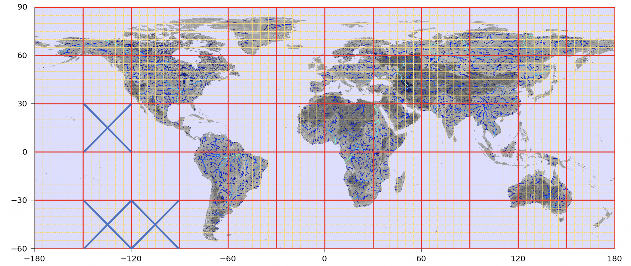
MERIT Hydro is a new global flow direction map at 3 arc-second resolution (~90 m at the equator) derived from the latest elevation data (MERIT DEM, http://hydro.iis.u-tokyo.ac.jp/~yamadai/MERIT_DEM/) and water body datasets (G1WBM, GSWO, and OpenStreetMap). A new algorithm was developed to extract river networks near-automatically by separating actual inland basins from dummy depressions caused by the errors in input elevation data. After a minimum amount of hand-editing, the constructed hydrography map shows good agreement with existing quality-controlled river network datasets in terms of flow accumulation area and river basin shape. The location of river streamlines was realistically aligned with existing satellite-based global river channel data. Relative error in the drainage area was smaller than 0.05 for 90% of GRDC gauges, confirming the accuracy of the delineated global river networks. Discrepancies in flow accumulation area were found mostly in arid river basins containing depressions that are occasionally connected at high water levels and thus resulting in uncertain watershed boundaries. MERIT Hydro improves on existing global hydrography datasets in terms of spatial coverage (between N90 and S60) and representation of small streams, mainly due to increased availability of high-quality baseline geospatial datasets. The new flow direction and flow accumulation maps, along with accompanying supplementary layers on hydrologically adjusted elevation and channel width, will advance geoscience studies related to river hydrology at both global and local scales.
Documentation
More information is available at: http://hydro.iis.u-tokyo.ac.jp/~yamadai/MERIT_Hydro/
References
-
Yamazaki D., D. Ikeshima, J. Sosa, P.D. Bates, G.H. Allen, T.M. Pavelsky (2019). MERIT Hydro: A high-resolution global hydrography map based on latest topography datasets Water Resources Research, vol.55, pp.5053-5073, doi: 10.1029/2019WR024873
Data availability
MERIT Hydro is available for download at http://hydro.iis.u-tokyo.ac.jp/~yamadai/MERIT_Hydro/.
mizuRoute
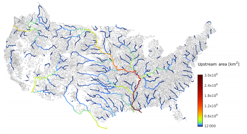
mizuRoute is a stand-alone runoff routing tool. The mizuRoute tool post-processes runoff outputs from any distributed hydrologic model or land surface model to produce spatially distributed streamflow at various spatial scales from headwater basins to continental-wide river systems. The tool can utilize both traditional grid-based river network and vector-based river network data. Both types of river network include river segment lines and the associated drainage basin polygons, but the vector-based river network can represent finer-scale river lines than the grid-based network. Streamflow estimates at any desired location in the river network can be easily extracted from the output of mizuRoute. The routing process is simulated as two separate steps. First, hillslope routing is performed with a gamma-distribution-based unit-hydrograph to transport runoff from a hillslope to a catchment outlet. The second step is river channel routing, which is performed with one of two routing scheme options: (1) a kinematic wave tracking (KWT) routing procedure; and (2) an impulse response function – unit-hydrograph (IRF-UH) routing procedure. The mizuRoute tool also includes scripts (python, NetCDF operators) to pre-process spatial river network data.
Documentation
More information is available at: https://mizuroute.readthedocs.io/en/master/
References
-
Mizukami, N., Clark, M. P., Sampson, K., Nijssen, B., Mao, Y., McMillan, H., Viger, R. J., Markstrom, S. L., Hay, L. E., Woods, R., Arnold, J. R., and Brekke, L. D.: mizuRoute version 1: a river network routing tool for a continental domain water resources applications, Geosci. Model Dev., 9, 2223–2238, https://doi.org/10.5194/gmd-9-2223-2016, 2016.
Data availability
mizuRoute is available for download from: https://doi.org/10.5281/zenodo.56043.