
Thematic Priorities
The Geospatial Intelligence theme focuses on developing advance capabilities on model configuration, process-based parameter estimation, and model evaluation/benchmarking. Work is planned in the following three areas:
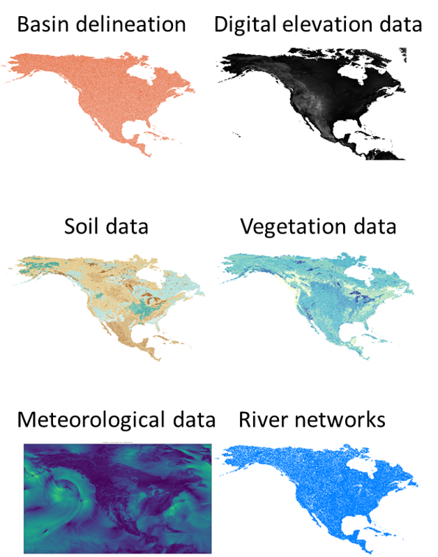
1. Model configuration. The modelling studies use common data on topography, vegetation, and soils, and have common processing steps to delineate catchments and rivers, to translate geophysical attributes to model parameters, and other pre-processing tasks. Work is planned to develop generalized methods to configure multiple models across the key basins in Canada. This work will synthesize efforts to implement large-domain models across Canada and focus on generalizing the model workflow. Key products will include generalized methods for terrain analysis and improved geophysical information. The end result will be datasets and workflows that can accelerate application of hydrologic models in Canada.
2. Process-based parameter inference. Current work on parameter sensitivity analysis is typically focused on simple models and small basins and does not address the problems of continental-domain hydrological modelling. This theme aims to quantify baseline performance for a range of alternative parameter estimation strategies. Non-mutually exclusive examples include: (i) apply parameter multipliers to spatial fields of a-priori parameters; (ii) develop a patchwork of parameter sets from single-basin calibrations and transfer model parameters to ungauged catchments; (iii) landscape calibration; and (iv) estimate parameters in the transfer functions used to translate geophysical attributes to model parameters. All of these methods will be pursued in a multi-objective context, using multiple observations and applying state-of-the-art multiple-objective and multi-response parameter inference strategies. This work provides the necessary foundation to improve the science of large-domain parameter estimation in Canada.
3. Model evaluation/benchmarking. The effort will consider both detailed measurements in research catchments (e.g., evaluate each process individually) as well as large-scale model benchmarks (e.g., satellite snow covered area, large-scale permafrost maps, GRACE, etc.). Much work has been done on CRHM evaluation in research catchments, and some work has been done with MESH. Moving forward, we will synthesize the past model evaluation efforts, synthesize the model evaluation data from headwater catchments and continental-domain products, and develop a common (model-agnostic) benchmarking system to rapidly evaluate the performance of new model simulations.
Faculty Leads
Loading...
Highly Qualified Personnel
Loading...
Collaborators
Loading...